Marine/Nautical - Caribbean 102.0
Paid Version
Publisher Description
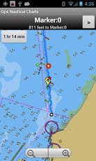


GPS Marine Charts App offers access to RNC charts covering Caribbean waters (incl. Nassau, Aruba, Cayman, Barbados etc.) with POI layers created from ENC charts. Only marine GPS app to have route assistance with Voice Prompts for marine navigation. It has route manager to create new boating routes or import existing GPX/KML routes. It supports Nautical Charts course up orientation.
Please visit http://gpsnauticalcharts.com/main/caribbean/all-all-caribbean-charts-nautical-charts-folio.html for complete list. If you don't find the chart for Caribbean, please contact us at support at gpsnauticalcharts.com.
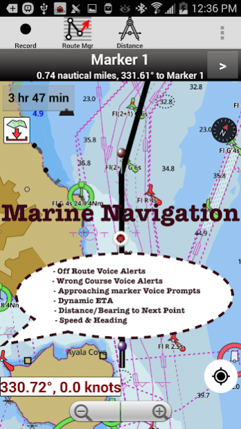
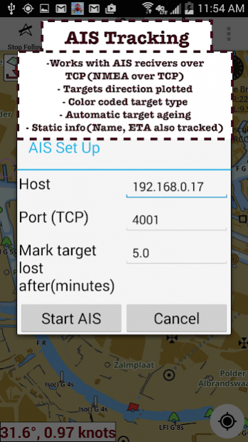
* Voice Prompts for marine navigation (requires GPS )
-prompts when approaching a boating route marker
-Continous distance and ETA updates
-Alerts when sailing/boating off route
-Alerts when boating in wrong direction
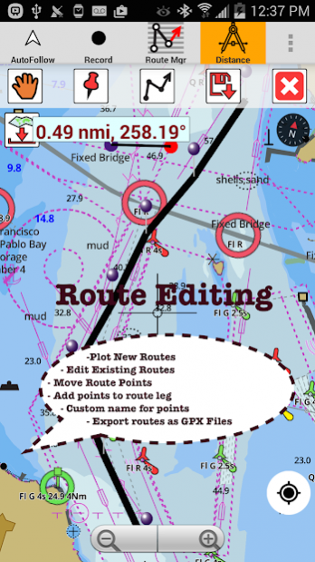
*Route Editing/Creation
-Create routes from scratch
-Edit existing GPX/KML routes.
-Add custom description to any route point.
-Drop markers along route.
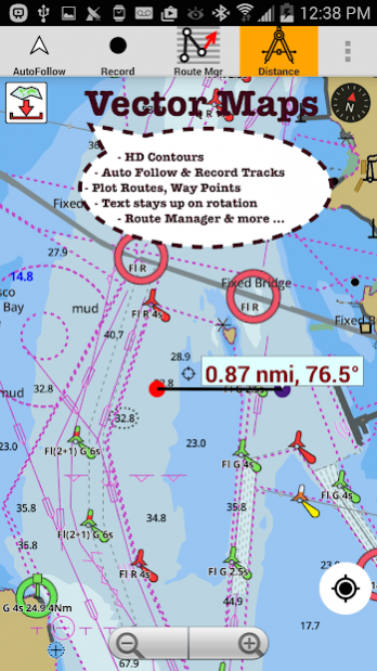
* Offline charts derived from UKHO data.
-Visually draw area to download
-Textual search
-Catalog (By state, region and coast guard district)
-Charts reprojected for WGS84 datum
►Instrumentation
√ AIS & GPS(NMEA over TCP/UDP)
√ Wind direction & Speed,Sonar depth,Water temperature
*Seamless chart quilting of marine charts
*Distance Bearing tool
*Create custom way points
- Using GPS
-Select point on map
-Manually enter latitude & longitude coordinates
*POI layer for marine charts
- Overlay POIs
- POI list derived from the equivalent ENC and contains all categories including Buoy, Light, Harbour facility, Obstr.
*Search POIs/Way points
*Pan/Zoom/My Location
* Record Marine GPS tracks
* View tracks overlay
* Live track animation
* Track analytics/stats
* Export GPX tracks.
-Export to SDCard
-Share GPX trakcs with friends/View on Google earth.
* Auto Follow Mode (Course up)
-Continuously updates boat's location on chart
- Adjustable update frequency
Sample Nautical Charts (please visit http://www.gpsnauticalcharts.com for complete list)
A Admiralty Bay
A Approaches to Kralendijk
A Aruba
A Bridgetown Harbour and Approaches
A Charlestown
A Commerce Bight
A Courland Point to Sandy Point
A Fort Baai
A - Golfo de San Blas including Puerto Mandinga
A Lisas Point to Pointe-A-Pierre
A Lucea Harbour
A Mustique
Anegada to Saint Thomas
Antigua
A Ocho Rios Bay
A Port Castries
A Port De Gustavia
A Port Esquivel
Approaches to Anguilla
Approaches to Barbados
Approaches to Guadeloupe
Approaches to Jamaica
Approaches to Kingston Harbour
Approaches to Nevis
Approaches to Trinidad and the Rio Orinoco
A Puerto Limon
A Saint David's Harbour to Prickly Bay
A Savanna la Mar
A Tobago Cays
A Watering Bay and Approaches
A Willemstad and Schottegat
B Approaches to Point Fortin and Brighton
Barbuda
B Bahia de Moin
B Big Creek and Approaches
B Black River Anchorage
B Caracas Baai- Spaanse Baai and Fuik Baai
B Charlestown Bay
B Clifton Harbour
Belize City and Approaches
Bequia to Canouan
B Grenada Bay and Approaches
B Haven Barcadera
B Hillsborough Bay
B Kings Bay
B Kingstown Harbour and Approaches
B Kralendijk
B Long Point Harbour
Bluefields Bluff to Man of War Cays
B Montego Bay
B Mosquito Cove
B Oistins Bay
Bonaire
B Port Morant
B - Puerto Nicuesa
B Saba
B Simson Baai
B Vieux Fort
Cabo Codera to Punta Aguide including the Outlying Islands
Caicos Passage and Mayaguana Passage
Canouan to Carriacou
C Approaches to Puerto Limon and Bahia de Moin
Carriacou to Grenada
C - Bahia Nombre de Dios and Rada Playa de Damas
C Baie De Marigot
C Caracas Baai
C Curacao
C Discovery Bay
C Goto (Bopec Terminal)
C Grand Cul de Sac Bay
C Grenville Harbour
Clifton Pier
C Man of War Bay
Cockburn Harbour
About Marine/Nautical - Caribbean
Marine/Nautical - Caribbean is a paid app for Android published in the Geography list of apps, part of Education.
The company that develops Marine/Nautical - Caribbean is Gps Nautical Charts. The latest version released by its developer is 102.0. This app was rated by 1 users of our site and has an average rating of 5.0.
To install Marine/Nautical - Caribbean on your Android device, just click the green Continue To App button above to start the installation process. The app is listed on our website since 2016-12-19 and was downloaded 13 times. We have already checked if the download link is safe, however for your own protection we recommend that you scan the downloaded app with your antivirus. Your antivirus may detect the Marine/Nautical - Caribbean as malware as malware if the download link to com.skiracer.nautical_astore_cb is broken.
How to install Marine/Nautical - Caribbean on your Android device:
- Click on the Continue To App button on our website. This will redirect you to Google Play.
- Once the Marine/Nautical - Caribbean is shown in the Google Play listing of your Android device, you can start its download and installation. Tap on the Install button located below the search bar and to the right of the app icon.
- A pop-up window with the permissions required by Marine/Nautical - Caribbean will be shown. Click on Accept to continue the process.
- Marine/Nautical - Caribbean will be downloaded onto your device, displaying a progress. Once the download completes, the installation will start and you'll get a notification after the installation is finished.
